Words by Larry Gore
People (Northerners) think Texas is just a dull, treeless, rolling plain that goes on forever — actually that would be the Panhandle. They don't realize we have the mountains of West Texas, (the highest peak is almost 9,000 feet), the ruggedness of Big Bend National Park, deserts — even painted deserts and canyons, like Palo Duro, that are almost beyond belief.
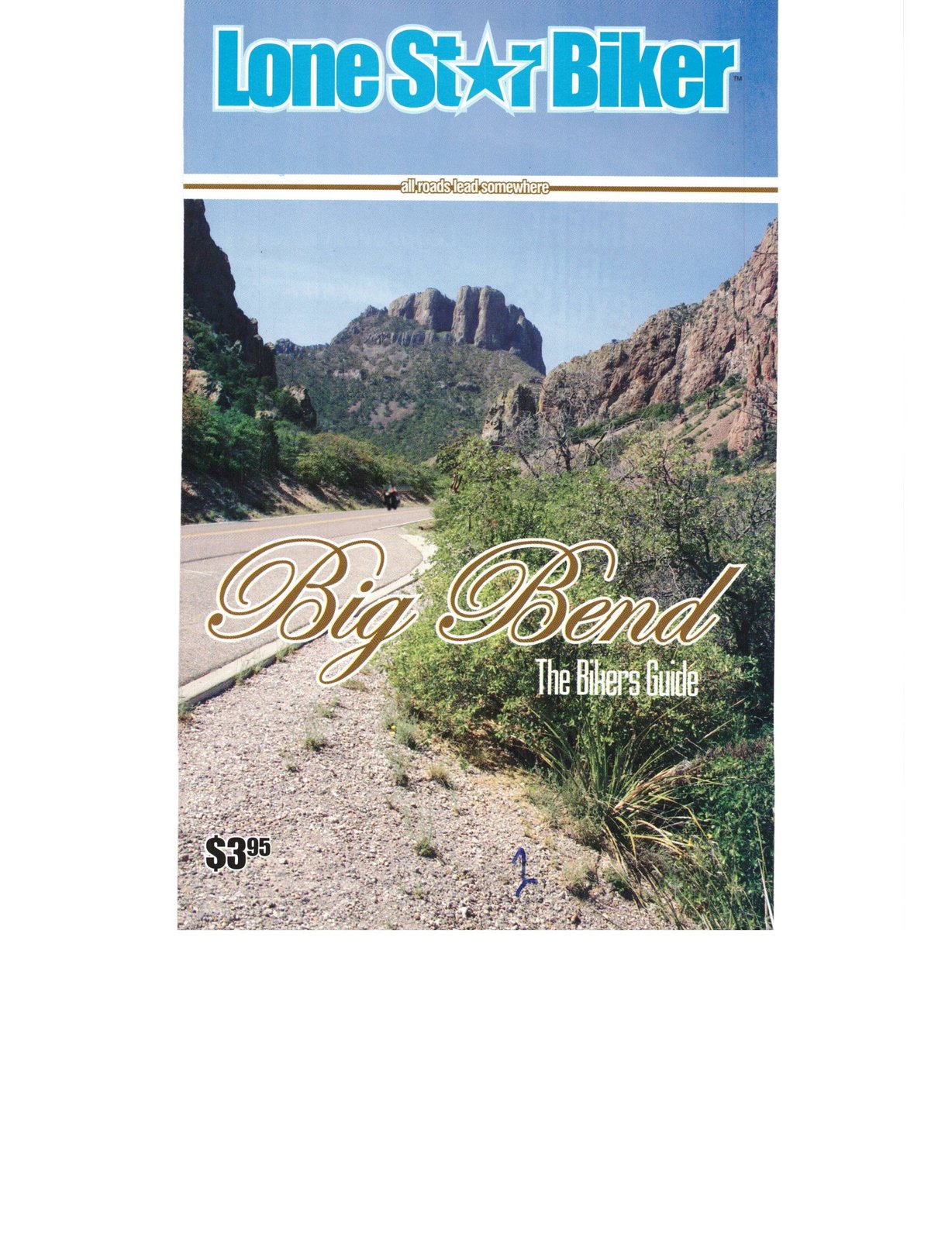
Big Bend Country is an awesome area in which to ride your bike. Here you see a part of Texas that most people don't even realize exists. Places like "The Basin" where nature has carved a window just because the view is so awesome. This is Big Bend Country deep in Southwest Texas. The area is a hot, dry, inhospitable but beautiful place. Every turn, every hill brings a new panorama of color, blue skies and strange geological formations.
Along with all of this Big Bend National Park is inhabited by snakes, scorpions, and buzzards. The land is punctuated with the thorns of cactus, underscored by heat. Drought, flash floods and spectacular lightening form the exclamation points. Whatever your favorite terrain is you are probably going to find a little of it here. So much to see and to photograph that it is necessary to stop frequently just to gawk. In the shade of one of the Teepees it is hard to realize that you are only about 600 miles – and two days riding – from Houston. This really is a world away.
People who visit Big Bend fall in love with the place and want to return again and again. In the midst of the harshness there is beauty – Bluebonnets, Indian Paintbrushes, flowering cacti and other plants too numerous to mention. Big Bend is the classic combination of The Beauty and The Beast. The strong and the weak, the hunter and the hunted all living together, a society where today's songbird becomes tomorrow's lunch for the buzzard. But that is the way God planned it. In the end everything in perfect balance and life goes on.
Day 1. Houston to Del Rio. The first day should be an easy 319-mile run from Houston (via back roads) to San Antonio, Castroville, Uvalde, Hondo, and into Del Rio for the night. "Should be an easy trip — not was an easy trip"
Catching Hail in West Texas. The hailstones that pounded us without mercy were getting larger by the minute. The wind was howling, the cold rain was dumping us in torrents, the dirt road beside the highway had become a small raging stream and our only "news" from the outside world was a weather bulletin that said we were almost directly in the path of a tornado.
Our entire group — at least those we could account for – were cold, soaked to the skin, and more than just a little bit scared. Several were bleeding from places where the hailstones had hit directly on unprotected skin. (We later found out that hailstones reach speeds of 110 to 125 mph!)
This was not the way the 31st annual Big Bend trip was supposed to start!
We were about 20 miles west of Bracketville and since leaving the last rest stop about 10 miles back we had watched an ominous black cloud moving rapidly, sending out constant bolts of lightening and on a path that would inevitably intercept with ours.
"Oh well, we are going to get wet but no big deal. After all we are only about 15 miles from our hotel for the night."
When the rain started in earnest the riders did their best to pick their way down the two-lane highway in spite of poor visibility and windshields and eyeglasses that were fogging up to the point of being useless. Several of us had pulled into the emergency stopping lane and dropped our speed as we tried to maintain some forward movement to get out of this mess.
Rounding a curve we saw a car upside down on the shoulder of the road with people stopping their cars and running towards the wreck. A quick look at the collapsed roof of the car made it clear that someone was in big trouble. There were plenty of cars stopping to help and really nothing we could do from a motorcycle so we pushed on through the storm.
“Ouch!”
When the first hailstone hit my hand it felt like a rock fired from a slingshot. Before I had time to react and realize what was happening there was a steady rat-a-tat-tat of the stones pelting the bike, my helmet, the roadway, the cars and everything else.
Pulling my bike as far off the highway as I could get it I did a quick take of my surroundings; no bridges, no overpasses, no shelter — just a couple of scraggly mesquite trees about 50 feet off the road. Each tree had at least one automobile that had pulled underneath to get shelter.
"Okay, let's review the safety rules;
Rule #1. In an electrical storm never take shelter under a tree.
Rationalization #1. I might get hit by lightening but I am definitely getting pounded by hailstones.
Conclusion #1. Ignore Rule #1 and seek the only shelter available. "
As I made a dash toward one of the trees I could see the driver of a Jeep toss something in the back seat and motion for me to get in.
"Thanks, but I am soaking wet, I don't want to mess up your car. "
"It's a Jeep, don't worry about it. Get in."
"Thanks, man. You don't know how much I appreciate this."
My host was in the Air Force and stationed at Laughlin AFB — about 3 miles ahead of us. He said that there was a tornado in the area and he had first tried to head East to get away from it and when the weather got worse he did a U-turn and headed back West, that was when he decided to get his vehicle under a tree — and lucky for me it was my tree.
After a few minutes in the Jeep it looked like it was clearing up when the skies opened up and all hail broke loose. The stones got larger, the winds got stronger, and the hail was tearing branches from the tree and pelting the canvas top of the Jeep with them.
Ahead under a tree I could make out one of my traveling companions and could see several more huddled under a tree across the highway. Boy, was I the lucky one! When it cleared after about 20 or 25 minutes I thanked the Jeep driver profusely, got out and waded through several inches of ice and water to where several other members of our group were gathered. The relief at being safe and unhurt bore itself out in laughter — for a few minutes everything seemed to be funny.
The rider that I had seen under the next tree had run to the tree only to find a coiled snake that had already found shelter under the same tree. At that moment the fear of a snake was less that his fear of getting beat to pieces by hailstones, so he won the coin toss and the snake had to leave.
TIP: In a hailstorm a helmet could literally save your life.
TIP: When I left home, I couldn't find my motorcycle jacket so I grabbed a suede jacket instead. In a rainstorm, suede becomes a giant piece of sponge that absorbs about 50 times its weight in water. Not only are you going to be wet but the suede takes days to dry out.
The last 15 miles to the hotel was one of the coldest, most miserable stretches that I have ever ridden on a motorcycle.
"It couldn't get worse than this."
My lane was flooded with about 6 inches of water that had a solid crust of ice on top. As I slowed down to thread my way across a pickup truck passed me in the left lane and sent a total wall of water over the bike and me. It seemed appropriate to point the single finger of a rain-soaked glove at him and suggest that he was involved in inter-generational sex as the offspring of an unmarried couple who swam the Rio Grande to gain access to the United States.
The motel was a welcome sight, but more so the impending opportunity to get out of cold wet clothes and into dry ones.
More importantly it was an opportunity to make sure that our entire group (some 40 or 50 riders) made it in safe.
Within a few minutes everyone was accounted for, everyone was safe and there were no major injuries and relatively little damage to any of the motorcycles. Everyone was anxious to outdo each others story of the storm, as the evening wore on the hailstones got larger, the snake got meaner, the water got deeper, and the lightening strikes got closer.
It has been written that "it's the trip not the destination" but for bikers it might be "the war stories later told, not the trip"
"Hail the size of bowling balls? … okay, this is where I have to draw the line!"
Day 2. Del Rio To Marathon. The landscape changes abruptly at Del Rio. Once across the Amistad Reservoir Lake you are really aware that you are in West Texas; rocky, dry, scrubby mesquite trees, sand, and lots of cacti. About 40 miles out a left turn and the road winds it way up a hill, the reason is soon clear – this is the overlook for the Pecos River Bridge. The bridge, 1310 feet long and at 273 feet high, is the highest highway bridge in Texas. The original bridge was built near here by the Railroad in the late 1800's. You have to marvel at how they were able to complete such a construction project over a hundred years ago.
Next stop: Langtry, TX (Population 18) Site of the Jersey Lilly Saloon/Judge Roy Bean's Courtroom – "The Law West of the Pecos!" There is a great not-to-be-missed (free) museum here run by the Texas Dept. of Transportation.
After Langtry there isn't much for miles and miles. In this country you had better top off your tank whenever you get a chance – gas stations can easily be a hundred miles apart. Don't even look at the price of the gas. Gas, at any price, is cheaper than the alternative.
Nearing Sanderson the road runs near the railroad track for a few miles. It seems that the freight trains are only minutes apart as they haul hundreds of tons across the desert.
At Sanderson it will be time to gas up, eat and re-hydrate your body. Just on the left as you come into Sanderson is the Johnny D Bar & Grill. They put out an awesome hamburger, one that really does "take two hands to handle". Sanderson and Johnny D's is the home to the Turkey Buzzard Rally normally held the first weekend of April. Check their website, www.buzzardrally.info, or call 432-345-2118 for more specific information. These are really nice people that own Johnny D's and they will make you feel right at home.
As you leave Sanderson you will see more and more mountains to your left and soon you will notice a much higher, pointed mountain off to your left. That is the 6,521 foot Santiago Peak. A 54-mile run brings you into Marathon, TX and one of the high points of the trip — The Gage Hotel. (See The Gage Hotel — a romantic getaway elsewhere in this guide.)
Day 3. BIG BEND NATIONAL PARK Presidio, Marfa, and Ft. Davis to Alpine.
The Big Bend Cycle Shop in Alpine can handle just about any problem you encounter with your motorcycle during today's ride. They can be reached at 432-837-3267. We have met them personally and they are a great bunch and willing to "go the extra mile" to help out.
Once inside Big Bend National Park the speed limit drops to 45 mph, but it is obvious that enforcement ability is limited. Park Headquarters is about 25 miles inside the park and the road to it is a lot of long, sweeping curves and gradual climbs. The Park Headquarters at Panther Junction, is a good place for a "pit stop", a cold drink, and if it is not too late in the day a place to gas up. The headquarters also provides a myriad of information about the park and the surrounding area.
Three miles west of Panther Junction there is a road to the left that goes up to Chisos Lodge and "The Basin". If you go to Big Bend without seeing The Basin then you have missed Big Bend and your trip is incomplete. The road up through Panther Pass (it is named "Panther" for a reason, be alert) can be challenging fun for even the most experienced biker. The road is steep with hairpin turns and daunting drop-offs beside the road. It is so much fun you will want to ride it a second time. The temperature can suddenly drop 20-degrees when you enter some of the canyons that rarely get full sun. Arriving at Chisos Lodge you will be able to look out of "The Window". The Basin nestles among the tall peaks and is open on one side – "the window" affords an incredible view of the valley, desert and mountains beyond. The National Park service runs a hotel and restaurant in The Basin – a great place to stay – but book well in advance.
The Window is one of those places where photos never do it justice, so let the scene burn itself into your memory.
When you leave the basin and return the Park Road 118 a left turn will take you towards Study Butte ("stoody bute"). The terrain becomes a series of challenging hills, curves and twisties. Don't make a mistake here – there are no guardrails to deflect you from going over the side. The biggest danger is that there is so much sensory-overload because of the scenery that you will get distracted from paying attention to your riding. Fortunately there are plenty of places to pull over to admire and photograph the scenery.
Just as you leave the park pay special attention to the desert on your left and the palette of colors that nature has used to paint them in broad brush strokes.
From Study Butte a quick 3-mile run takes you to "La Kiva" an underground bar and restaurant right next to a dry creek bed. The place is built into – and under – an outcropping in the side of the hill. Very rustic with barstools made of petrified wood and one of the most massive single-piece tabletops I have ever seen. Made from a cotton wood tree, the board is about 5 inches thick, 5 feet wide and over 25 feet long. The food is outstanding and even though the place is not air-conditioned it is always cool because of the way it is built into the side of hill.
Terlingua (home of the famous Chili Cookoffs) is next. Here the roads become like a roller coaster, only more fun. The hills are a couple of hundred feet high and crest sharply at the top, followed by stomach-lurching, neck-snapping dips at the bottoms.
After 12 miles of these roller coaster hills you will arrive at Lajitas. Be sure to stop at the Big Bend Ranch State Park visitor center on the left as you come into town.
The Lajitas (la-hee-tas) Trading Post has been in business since 1899. Until recently this was the home of Henry Clay, the beer-guzzling goat, but the animal rights activists have made Henry go on the wagon.
Lajitas to Presidio is home to the "River Road" considered by many to be one of the finest motorcycling roads in the country. The 50-mile run will excite every fiber of your body.
"The road abruptly crested the hill and then made a sharp right turn almost immediately. A vertical rock wall on my right and a sheer drop to the Rio Grande River on my left leaves little room for error. Jamming the gearshift down into second and leaning hard I was able to get the Harley setup properly for the turn and twisted the throttle slightly to roll out of the curve.
Should I trust the next rider or slow down and look over the hill first? With a pounding heart I decided to trust him and set up for a sharp left on the down side of the hill. Over the hill, downshift to second and lean into a hard turn. It was a correct choice – that was the way the road went. We are less than 6 miles into the famous (or infamous) 49.7 miles River Road from Lajitas to Presidio, Texas. You will be thinking "it doesn't get any better than this" but I assure you that it does.
Sweeping around a long curve there are Teepees on the left. It's a roadside park and a good place to take a break and catch your wind. Everyone stops for a break – in this desert country you have to constantly guard against dehydration. Out here if anyone got injured you would not want them left exposed to the elements, or the snakes or scorpions, very long. Almost immediately after leaving the Teepees there is a steep "trucks use lower gear" 15% grade, full of switchbacks leading to the highest point on this run. From the peak the views of the Rio Grande River and Big Bend National Park are incredible. Picture Time!"
On to Presidio, frequently "the nation's hotspot". The roadside park in Presidio will be a welcome sight. Finding a good restaurant in Presidio can be difficult but a local grocery store offers fried chicken and snack foods.
From Presidio headed for Marfa (60 miles) the land changes dramatically to long gentle hills, mostly straight roads with sweeping curves. It is a different kind of riding from the earlier one, but still a lot of fun. Watch for "Elephant Rock" and "Abe Lincoln's Profile" natural rock formations on your left.
Marfa is home to a phenomenon of the "mysterious lights of Marfa". If you want to catch the show, plan on being there at sunset.
At Marfa you might want to opt to go another 22 miles and visit Fort Davis. Besides being rich in Texas' military history, Fort Davis is at the start of the scenic loop for the Davis Mountains and home to the MacDonald Observatory. Fort Davis is a quaint little place very reminiscent of the Old West. Take the time to see the old fort, the museum, the MacDonald Observatory (not the people with the "Golden Arches" and explore the town.
The warning signs for deer are here for a reason. Grazing deer are everywhere along the side of the roads. At one point I counted over 40 in one herd peacefully munching grass. They mean big danger for a bikers after dark, so beware.
The Davis Mountains Loop at Ft. Davis is an outstanding ride. The loop is a little over 100-miles long and takes several hours to make, allowing adequate time for sight seeing. This ride is best saved for another day since the loop, McDonald Observatory and Ft. Davis have so much to see that it takes an entire day just for them.
On this specific trip we stayed at the Sunday House motel in Alpine. After a long day in the saddle try the Longhorn Cattle Co. restaurant in Alpine (801 N. 5th. Street. 915-837-3692) named one of the top 10 Steakhouses in Texas — and for good reason.
Day 4. Alpine to Kerrvile. A long day taking you from the dry, parched desert to the lush, cypress-lined banks of the Guadalupe River. Just outside Alpine is a junction where US 67 heads North to Fort Stockton and US 90 continues East through Del Rio. Either way it was a case of "you can't get there from here" when looking at Alpine and Kerrville on the map.
The Fort Stockton route takes you to I-10 and a 240-mile run at Interstate speed would put you in Kerrville. Fast and easy but watch out for the 18-wheelers. US 90 will mean a lot of towns, traffic lights and an indirect, but fun route through the Texas Hill Country from Hondo.
The I-10 group did a little map strategy at the next rest stop and decided to take I-10 only to Sonora (100 miles) and then head South to get back into the Texas Hill Country. This route would offer a 20-mile ride along a river road following the Guadalupe River to Hunt, TX.
I-10 was fast – with very tough crosswinds. You realize how windy this area is when you see the large windmill farm East of Fort Stockton. The view of the first of hundreds of white, wind turbines lining the tops of the mesas looks as is somewhat has planted some sort of strange garden. These wind turbines of the Green Mountain Energy Company harness the relentless winds of west Texas and convert them to electricity. They are here, you quickly realize, because the winds of West Texas seem never to let up. The same wind waits atop the roadway only to swoop down through the rocky passes shifting direction violently. These winds can put a bike (or an 18-wheeler) in a different lane before the rider has a chance to blink.
The wind buffets you about, gives your face a major case of windburn and severely increases your pucker factor. Yet, when the ride is over the reaction is "wow, can you believe that wind"- let the tall tales begin.
This part of I-10 is a long, mostly straight road with very mesa after mesa all looking pretty much the same. In other words – it is boring! Although a quick look at the speedometer assured me I was burning up some miles it seemed like I was getting nowhere.
At Sonora we decided to leave I-10 and cut southeast towards Rocksprings and over to Mountain Home. The Hill Country has hundreds of miles of fun roads accompanied by incredible scenery and it really draws the biker crowd (See the Lone Star Biker Guide to The Texas Hill Country.)
After the harshness of Big Bend the first views of the Guadalupe River were unbelievably beautiful. In Big Bend you will cross hundreds of streams, creeks and rivers that are nothing but dry riverbed and dust. After that the Guadalupe is so green and clear and cool and inviting. Lush grass and stately cypress trees line the edges of the river in both directions. Dozens of small dams create great pools of calm water that provide locals with the best swimming pools in the world — those designed by nature.
Finally we arrive at the Y O Ranch Resort Hotel in Kerrville. This is the official end of the Big Bend Trip and we dismount with mixed emotions. Sad that that trip is over and elated at the things we have seen and experienced.
Why do we do trips like this? Maybe it harkens back to the days of the old west. The cowboys being out in the open working a cattle drive, crossing the country, exploring the land of the west. What ever it is, it gets in our bloodstream it stays there. The heritage of the old cowboy has been passed down through generations to the biker of today.
After a trip like this you will understand what inspired Kathryn Lee Bates to pen the following words during her cross-country trip in 1893:
"O beautiful for spacious skies, For amber waves of grain, For purple mountain majesties Above the fruited plain! America! America! God shed his grace on thee And crown thy good with brotherhood From sea to shining sea!"
Footnote. If you might like to join the Lone Star Biker staff on one of our trips, let us know by dropping us an email to larry@lonestarbiker.com.